Territory
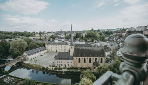
Luxembourg City has an area of 51.73 km², making up about 2% of the nation's territory. It has a circumference of 52.5 km.
Other figures:
- 30% of the city is covered by buildings;
- 27.7% of the city is covered by agriculture;
- 22% of the city is covered by forest;
- 8.7% of the city is covered by streets and squares;
- 1.5% of the city is covered by industrial facilities;
- 0.7% of the city is covered by waterways.
Luxembourg City is located at 49°36'36"N, 6°7'40"E. Its altitude ranges from 232 m (Beggen, Rue de Bastogne) to 408 m (Dommeldange plateau), and is 304 m in the city centre (Place d'Armes).
The average temperature is 9.0°C (measured in Findel).
Population matters
Total population (as at 31 December 2024): 136,208 residents
- Luxembourg: 40,686 (29.87%)
- Foreigners: 95,522 (70.13%)
Distances to cities in neighbouring countries
Having borders with Belgium, France and Germany, Luxembourg is in the heart of Europe:
| France | Germany | Belgium |
|---|---|---|
|
Metz: 60 km |
Trier: 48 km |
Liège: 168 km |
|
Strasbourg: 222 km |
Saarbrücken: 100 km |
Brussels: 225 km |
|
Paris: 370 km |
Köln: 197 km |
Antwerp: 254 km |
Motorway network
Six motorways directly connect the capital to these neighbouring cities:
- the A1 to Cologne and Frankfurt;
- the A13 to Strasbourg and Saarbrücken;
- the A3 to Metz, Nancy and Paris;
- the A4 to Esch-sur-Alzette;
- the A6 to Namur, Brussels, Liège and Maastricht;
- the A7 to Aachen;
City staff
To be able to properly provide for its residents, the City of Luxembourg has around fifty administrative, technical, cultural, social and socio-educational departments.
| Status | Women | Men | Total |
|---|---|---|---|
| City employees | 48 | 25 | 73 |
| Civil servants | 469 | 1,249 | 1,718 |
| Employees (former private sector employees) | 674 | 395 | 1,069 |
| Workers (former labourers) | 572 | 1,020 | 1,592 |
| TOTAL | 1,763 | 2,689 | 4,452 |


